It was brought to our attention that the Jefferson County Commissioners was rumored to be contemplating INCLUDING the two proposed sites in the Metolius River Basin in their mapping of destination resort designations in defiance of the recent 'ban' signed by the Governor of Oregon. No one really knew what this might mean.
NOW comes word that this will NOT happen, but rather the following statement has been issued:
"The Jefferson County Board of Commissioners voted unanimously to remove the two contested Metolius Basin sites from the County's Destination Resort Eligibility Map. The Commission directed staff to prepare an ordinance for adoption that provides the Comprehensive Plan basis as well as the necessary zoning standards to regulate any future proposals however no map will be adopted identifying resort eligible sites. This action provides the framework for resort proposals outside of the Metolius Area of Critical State Concern to be reviewed for compliance with state and county requirements in the future. The first reading of the ordinance will be January 13, 2010."
John Skidmore, AICP Planning Director/CDD Manager, Jefferson County
This may finally slam the door on the issue, but can one ever really be sure?
Monday, December 28, 2009
Friday, December 4, 2009
LCDC Public Hearing Notes from 12/3
Last night's LCDC public hearing in Camp Sherman offered clarification on the proposed changes to the Area of Critical State Concern (ACSC) Management Plan. Three changes are proposed:
1. Implementing a process requirement for changing the management plan in the future.
2. Altering the clustering or row system for the limited development granted to the Ponderosa property east of Green Ridge and north of Black Butte.
3. Clarification of wording regarding average annual water consumption, meant to apply to all usage, which was accidentally ommitted in one area.
On January 21st in Salem, the LCDC will hold a full commission meeting to take action on the proposed changes to the ACSC.
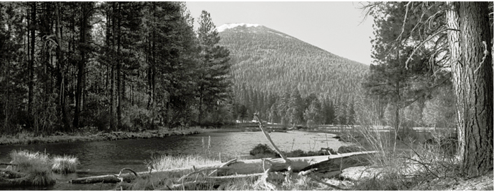
The two (2) areas of land covered under the ACSC Management Plan offer varying degress of protection. The hydrologic area, Area 1, holds the highest degree of protection. Area 1 prohibits large scale development and places a limit on the number of homes (10) and limits the average annual water use, which corresponds directly to the number of dwellings. Area 2 protection is not as stringent, allowing 20 dwellings.
The Poderosa property straddles Areas 1 and 2, entailing approximately 320 acres of land. Small scale development is granted for this property. A hearing to map the 320 acres of Ponderosa land will be held in Camp Sherman Community Hall on December 9th at 6:00 PM.
1. Implementing a process requirement for changing the management plan in the future.
2. Altering the clustering or row system for the limited development granted to the Ponderosa property east of Green Ridge and north of Black Butte.
3. Clarification of wording regarding average annual water consumption, meant to apply to all usage, which was accidentally ommitted in one area.
On January 21st in Salem, the LCDC will hold a full commission meeting to take action on the proposed changes to the ACSC.
The two (2) areas of land covered under the ACSC Management Plan offer varying degress of protection. The hydrologic area, Area 1, holds the highest degree of protection. Area 1 prohibits large scale development and places a limit on the number of homes (10) and limits the average annual water use, which corresponds directly to the number of dwellings. Area 2 protection is not as stringent, allowing 20 dwellings.
The Poderosa property straddles Areas 1 and 2, entailing approximately 320 acres of land. Small scale development is granted for this property. A hearing to map the 320 acres of Ponderosa land will be held in Camp Sherman Community Hall on December 9th at 6:00 PM.
Subscribe to:
Posts (Atom)
MRFHA - Camp Sherman

Metolius River